March 14th, we took off in the Jeep Grand Cherokee and headed for Death Valley. We were going to take the Wrangler, but Ken found out before we left that the main trail we wanted to tour (Titus Canyon) was closed due to flood damage, so we took the Cherokee and rode in comfort. Our reservations at Stove Pipe Wells Village was for March 15-19, so we stayed in Pahrump our first night. Yes, we even did a little caching there.
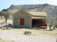
March 15th, we took off early and drove to Rhyolite where we stopped and toured the old ghost town. Rhyolite is the largest ghost town in Death Valley! Rhyolite had a population of nearly 10,000 people between 1905 and 1911. The town had 2 churches, 50 saloons, 18 stores, and much more… Many ruins are still there including a Bottle House, part of a three-story bank, and more.
We left Rhyolite and drove to Stove Pipe Wells where we met up with friends, Dave & Sandy, and after checking into our room, we took off to Artist’s Drive, then Zabrinski Point to watch the sunset. This is just a sample of the color we saw before the sun set.
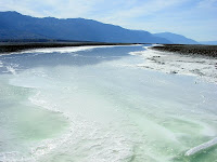
Tuesday, Ken & I met up with Dave & Sandy for breakfast, then we all headed out to the Badwater Basin area of Death Valley and drove the West Side Road all the way to Ashford Mill. We stopped along the way at many sites and even had lunch at the Eagle Borax Works Ruins.
After the long drive over the sometimes washboardy gravel road we all headed back to our room and had snacks and drinks for the evening. Dave & Sandy had to leave early on Wednesday, so they headed back to their trailer around 6pm to pack and get ready to pull out.The one high clearance, off-road drive we really wanted to do was Titus Canyon. The drive is approximately 28 miles on a mostly one-way unpaved road. It stretches from just west of Rhyolite in Nevada (near Beatty) from highway 374 to the Scotty’s Castle Road in Death Valley. The road was closed because of a huge rock slide in the narrows and wasn’t due to open until Friday the 19th (the day we were leaving…bummer). Our only option was drive to the mouth of the canyon via the 3 mile east-bound portion of the road and hike uphill through the narrows (another 3 miles).
Once we got to the mouth of Titus Canyon, we were pleased to see the narrows portion of the canyon had been recently graded. The narrows are just wide enough for a small truck, with a constant uphill climb in sand and gravel. It's a huge drainage/wash channel for the nearby Grapevine mountains. I ended up walking just over a mile in and decided to turn around because I knew my knee would be killing me on the walk back out. Ken continued walking another 2 miles through the narrows and past the slide. He was pleased to see the slide had been cleared and kinda wondered WHY the road was still closed. We found out later the officials were waiting till the threat of rain was over, which was supposed to be on Friday. Oh well, we were happy to just be able to do what we did.
After leaving the canyon, we drove on up to Scottys Castle to find the answers to a couple of geocache virtuals. The park does not allow ANY physical caches to be placed in it, but you can have what is called Earth Caches, and Virtuals. We even ate our lunch there and were greatly surprised to run into a couple we know (Larry & Laura) from Spokane, Washington. They were in-between tours, so we visited until they were ready to go on their second tour.
On Thursday the 14th, we toured some other sites and had lunch in Furnace Creek. After lunch, Ken talked to one of the park rangers and was surprised to learn Titus Canyon had opened up early that morning. We didn’t even have to think about it…. we got back in the Jeep and headed out of the park to the Titus Canyon Cutoff and headed on in.
We crossed the National Park Boundary about 2 miles in when the road became a drainage channel (wash). About 7 miles in, we started getting into the Grapevine Mountains. We went through two passes (White Pass and Red Pass) with some spectacular views into the Valleys. Oh boy that was an experience! The road was narrow & twisty, with many steep drop-offs.
After some white knuckles on my part (Ken was fine) and 16 miles in, we stopped at the ghost town, Leadfield. All that remains of Leadfield are the ruins of a wood and a tin building along with some cement foundations of the mill. They mined for lead there in 1926-1927.
Just outside Leadfield, we entered Titus Canyon. The road once again became thick loose gravel as we drove through several wash/drainage areas. At 22 miles in, we came to the Narrows portion of the canyon. The narrows portion is 3 1/2 miles long, with many twists and turns. We came to the mouth of Titus Canyon after driving 25 1/2 miles and were once again back on the busy two-way portion of the road. It was a long day, but so very worth it.
After we got back to our room, the sky darkened, the wind started blowing and we had a full force sand storm. We were soooo glad we were not on the road when that came through. The visibility dropped almost to zero during the height of the storm, but soon it was all over and back to normal.


